The image presents an aerial satellite view of an island archipelago, showcasing the complex layout and geographic features. From this top-down perspective, we can see various land masses surrounded by expanses of water, indicating the diverse natural landscape of the region. The islands are densely populated, with numerous buildings dotting their surfaces, suggesting a high level of human activity and settlement. Above and below these structures, roads and infrastructure can be discerned, further highlighting the extent of human habitation in this area.
The surrounding water bodies exhibit a range of colors from lighter shades near the land masses to darker hues in deeper areas, providing a stark contrast between land and sea. This visualization is likely used for planning purposes, such as navigating travel routes, understanding demographics, or assessing environmental impacts on this archipelago. The intricate details of both the land forms and water bodies make it an engaging puzzle game image, inviting players to explore the interconnections between these elements.
This is a vibrant and appetizing photograph of a breakfast spread. The image features an array of breakfast foods, including fresh fruit, yogurt, panc...
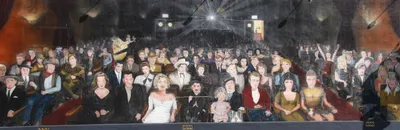
The image presents a vibrant collage of various scenes from an indoor auditorium. At the heart of the composition is a bustling scene where a group o...
The image presents a captivating scene of an ancient Chinese city gate, bathed in the warm glow of daylight. Dominating the center of the frame is a...
Discover an artful challenge in this visually captivating image designed for a puzzle game. The scene is awash with a vibrant palette of yellow, blue...
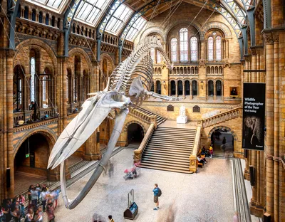
This image captures a breathtaking scene inside the Natural History Museum of London, specifically within the famous Dinosaurs in the Age of Giants e...
The image presented is a captivating piece of abstract art, bursting with vibrant hues that create an intriguing visual experience. The predominant c...